Search Constraints
« Previous |
1 - 12 of 16
|
Next »
Search Results

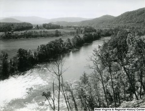
- Identifier:
- am2862_moore_0931
- Title:
- Photograph looking up Greenbrier River from Gunpowder Ridge
- Date:
- 1955-07-05
- Creator:
- United States. Forest Service
- Contributor:
- Prater, Leland J.
- Publisher:
- West Virginia & Regional History Center
- Subject Topical:
- Monongahela National Forest (W. Va.), Wild and scenic rivers, Greenbrier River (W. Va.), Landscape photography, Landscapes, and Rivers
- Subject Corporate:
- Monongahela National Forest (Agency : U.S.)
- Location:
- Greenbrier County (W. Va.)

- Identifier:
- am2862_moore_0929
- Title:
- Photograph of Seneca Rocks viewed from U.S. Route 33
- Date:
- 1955-06-26
- Creator:
- United States. Forest Service
- Contributor:
- Prater, Leland J.
- Publisher:
- West Virginia & Regional History Center
- Subject Topical:
- Monongahela National Forest (W. Va.), Spruce Knob-Seneca Rocks National Recreation Area (W. Va.), Landscape photography, Views, and Landscapes
- Subject Corporate:
- Monongahela National Forest (Agency : U.S.)
- Location:
- Pendleton County (W. Va.)

- Identifier:
- am2862_moore_0925
- Title:
- Photograph of North Fork Valley from Wildcat Hill
- Date:
- 1933
- Creator:
- United States. Forest Service
- Contributor:
- Shipp, E. S.
- Publisher:
- West Virginia & Regional History Center
- Subject Topical:
- Monongahela National Forest (W. Va.), Wild and scenic rivers, Landscape photography, Landscapes, and Water
- Subject Corporate:
- Monongahela National Forest (Agency : U.S.)
- Location:
- Pendleton County (W. Va.)

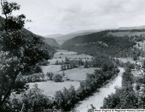
- Identifier:
- am2862_moore_0926
- Title:
- Photograph of Cheat River near St. George
- Date:
- 1935
- Creator:
- United States. Forest Service
- Contributor:
- Shipp, E. S.
- Publisher:
- West Virginia & Regional History Center
- Subject Topical:
- Monongahela National Forest (W. Va.), Wild and scenic rivers, Landscape photography, Views, Cheat River (W. Va. and Pa.), Rivers, and Landscapes
- Subject Corporate:
- Monongahela National Forest (Agency : U.S.)
- Location:
- Tucker County (W. Va.)

- Identifier:
- am2862_moore_0932
- Title:
- Photograph of a aerial view of Summit Lake
- Date:
- 1962-08-24
- Creator:
- United States. Forest Service
- Contributor:
- Prater, Leland J.
- Publisher:
- West Virginia & Regional History Center
- Subject Topical:
- Monongahela National Forest (W. Va.), Aerial photography, Landscape photography, Aerial photographs, Lakes, Landscapes, Reservoirs, and Water
- Subject Corporate:
- Monongahela National Forest (Agency : U.S.)
- Location:
- Greenbrier County (W. Va.)

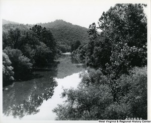
- Identifier:
- am2862_moore_0227
- Title:
- Photograph of the Elk River from the bridge in Gassaway, W.Va.
- Date:
- 1959-07
- Creator:
- United States. Forest Service
- Contributor:
- Prater, Leland J.
- Publisher:
- West Virginia & Regional History Center
- Subject Topical:
- Monongahela National Forest (W. Va.), Wild and scenic rivers, Bridges, Elk River (W. Va.), Landscape photography, Views, Landscapes, Rivers, and Water
- Subject Corporate:
- Monongahela National Forest (Agency : U.S.)
- Location:
- Braxton County (W. Va.) and Gassaway (W. Va.)

- Identifier:
- am2862_moore_0228
- Title:
- Photograph of Back Creek
- Date:
- 1935
- Creator:
- United States. Forest Service
- Contributor:
- Shipp, E. S.
- Publisher:
- West Virginia & Regional History Center
- Subject Topical:
- Monongahela National Forest (W. Va.), Wild and scenic rivers, Landscape photography, Views, Landscapes, Potomac River, and Rivers
- Subject Corporate:
- Monongahela National Forest (Agency : U.S.)

- Identifier:
- am2862_moore_0230
- Title:
- Photograph of the Cheat River below St. George
- Date:
- 1935
- Creator:
- United States. Forest Service
- Contributor:
- Shipp, E. S.
- Publisher:
- West Virginia & Regional History Center
- Subject Topical:
- Monongahela National Forest (W. Va.), Wild and scenic rivers, Landscape photography, Views, Cheat River (W. Va. and Pa.), Rivers, and Landscapes
- Subject Corporate:
- Monongahela National Forest (Agency : U.S.)
- Location:
- Tucker County (W. Va.)

- Identifier:
- am2862_moore_0229
- Title:
- Photograph of Swallow Rocks on Gandy Creek, Randolph County, W.Va.
- Date:
- 1942-06-18
- Creator:
- United States. Forest Service
- Contributor:
- Morin, W. H.
- Publisher:
- West Virginia & Regional History Center
- Subject Topical:
- Monongahela National Forest (W. Va.), Wild and scenic rivers, Landscape photography, Views, Landscapes, and Rivers
- Subject Corporate:
- Monongahela National Forest (Agency : U.S.)

- Identifier:
- am2862_moore_0232
- Title:
- Photograph of Route #5 near Seneca
- Date:
- 1933
- Creator:
- United States. Forest Service
- Contributor:
- Shipp, E. S.
- Publisher:
- West Virginia & Regional History Center
- Subject Topical:
- Monongahela National Forest (W. Va.), Roads, Spruce Knob-Seneca Rocks National Recreation Area (W. Va.), Scenic byways, Landscape photography, Views, Landscapes, and Dirt roads
- Subject Corporate:
- Monongahela National Forest (Agency : U.S.)
- Location:
- Pendleton County (W. Va.)

- Identifier:
- am2862_moore_0233
- Title:
- Photograph of Sherwood Lake
- Date:
- circa 1960-1969
- Creator:
- United States. Forest Service
- Contributor:
- Obyc, Richard J.
- Publisher:
- West Virginia & Regional History Center
- Subject Topical:
- Monongahela National Forest (W. Va.), Wild and scenic rivers, Sherwood, Lake (W. Va.), Landscape photography, Views, Lakes, Landscapes, and Water
- Subject Corporate:
- Monongahela National Forest (Agency : U.S.)
- Location:
- Greenbrier County (W. Va.)

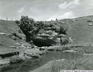
- Identifier:
- am2862_moore_0234
- Title:
- Photograph of the sinks of Gandy Creek
- Date:
- 1942-06-18
- Creator:
- United States. Forest Service
- Contributor:
- Morin, W. H.
- Publisher:
- West Virginia & Regional History Center
- Subject Topical:
- Monongahela National Forest (W. Va.), Wild and scenic rivers, Caves, Landscape photography, Landscapes, Rivers, and Water
- Subject Corporate:
- Monongahela National Forest (Agency : U.S.)


